Silver Falls Loop Trail
in Mount Rainier National Park

If you are itching to hike through a forest that is a postcard of the northwest, Silver Falls Loop Trail is for you. To make things even better, the 3-mile circuit (with 300 feet of elevation gain) also visits a thundering 70-foot waterfall on Ohanapecosh River. This is a premier woodland hike in the southeast corner of Mount Rainier National Park.
Depart from Ohanapecosh Visitor Center up Hot Springs Nature Trail, where you will learn to identify several common plants in the forest. The trail weaves its way past a small spring, where a shallow runoff of sulfur-scented water streams along the trail.
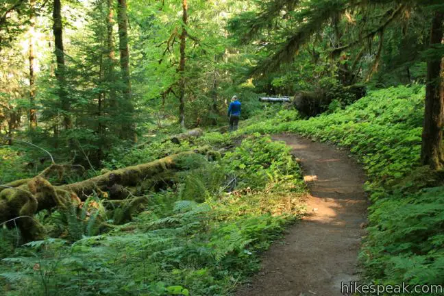
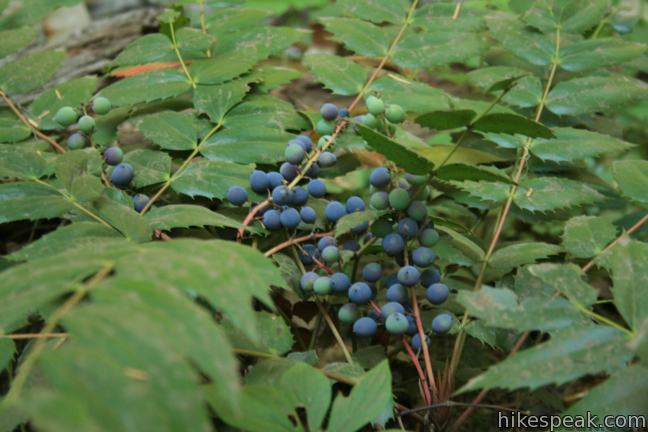
Turn right at the end of the trail and continue another 1.3 miles toward Silver Falls. The trail passes through a forest of Douglas firs, red cedars, and western hemlock above a lush floor of moss, maidenhair ferns, and Oregon grapes.
Just past a footbridge over Laughingwater Creek, the trail maneuvers to the right bank of Ohanapecosh River, high above the water. Turn left at a junction with Laughingwater Creek Trail and drop down to Silver Falls, 1.6 miles from the start.
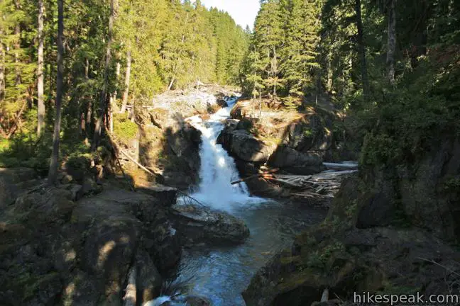
A wooden bridge crosses the gorge just below the gushing waterfalls. Cross the planks, admiring the teal blue water and orange rocks below. Across the bridge, the trail angles up to the right and climbs to an overlook near the brink of the falls. This is the most intimate prospective of Silver Falls.
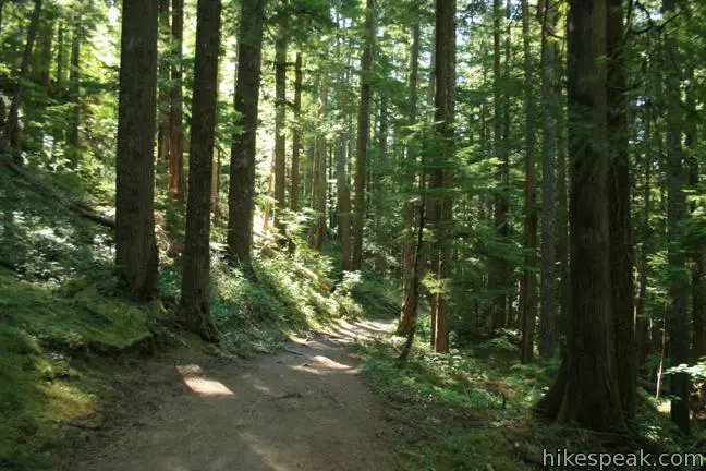
From here you would expect to turn downhill along the bank of the river. Instead the trail leaves the water and continues to climb. Can a trail be uphill both ways? This loop comes close, providing a gradual uphill grade for about 80% of the hike. That’s about the only “downside” of this shaded hike through an old-growth forest.
If the 600 year old trees along the loop fail to impress you, you can take a side trip to the Grove of the Patriarchs, adding two miles to the hike. Some of the trees on this sheltered island are a thousand years old.
To continue on the loop, bear left at the junction with Grove of the Patriarchs Trail, which comes a short distance past Silver Falls. Make another left at a junction with Cowlitz Divide Trail. You will climb farther up the side of the valley, passing through interesting moss-covered rock formations. Eventually the trail does turn downhill and drops rapidly to the campground. Turn left when you hit the road, cross a bridge over Ohanapecosh River, and walk up loop B to your vehicle at the trailhead.
Mount Rainier National Park has an entrance fee that is required to access this trail, but no permit is required to hike to Silver Falls.
Ohanapecosh Campground offers 188 sites in a lush wooded setting. Sites may be reserved for $20 per night. Two group sites can be reserved for $60 per night (prices as of 2017). The campground is open seasonally from May to October. Potable water and flush toilets are available (and there is a spigot near the trailhead). The campground is situated at 1,900 feet, making it the lowest developed campgrounds in Mount Rainier National Park. This elevation offers warmer nights that higher campgrounds, but don’t count on much sunlight during the day.
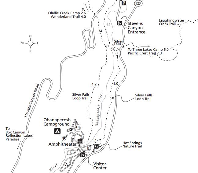
To get to the trailhead: The start of Silver Falls Loop Trail is located next to the Ohanapecosh visitor center in the southeast corner of Mount Rainier National Park (on Route 123, 1.75 miles south of the Stevens Canyon Entrance Station at the junction with Stevens Canyon Road). To reach the trailhead from the south, take Route 12 to Route 123 (7.5 miles east of Packwood), turn north and drive 3.5 miles to the Ohahapecosh Visitor Center and Campground on the left. Turn off Route 123 and drive into the campground. Pass the visitor center and make the first right into the B loop of the campground. Leave your vehicle in the day use parking area to the right. Walk past the “tree cookie” to the start of Hot Springs Nature Trail. You may stop by the visitor center to pick up a trail map and park guide before setting out.
Trailhead address: Washington Route 123, Mount Rainier National Park, Packwood, WA 98361
Trailhead coordinates: 46.7362, -121.5664 (46° 44′ 10.3″N 121° 33′ 59″W)
View Mount Rainier National Park in a larger map
Or view a regional map of surrounding Washington trails and campgrounds.
 | Skyline Trail This tremendously scenic loop on the slopes of Mount Rainier is considered the park's must-do hike. |
 | Naches Peak Loop Trail This colorful 3.75-mile loop crosses fields of summer wildflowers, passing subalpine lakes and great views of Mount Rainier. |
 | Mount Fremont Lookout This picturesque 6-mile trail visits a fire lookout tower near the summit of Mount Fremont, with incredible views over Mount Rainier and the surrounding mountains. |
 | More trails in Washington Explore other hikes in the Evergreen State, including Mount Saint Helens National Volcanic Monument. |
 | Camping in and around Mount Rainier Information on the developed campgrounds in Mount Rainier National Park as well as places to camp in the surrounding national forest. |


Can you mountain bike on the silver falls trail packwood, wa??
Bikes and dogs are prohibited on trails in Mount Rainier National Park
I have visited Mt. Rainier twice since 71. This was the first place we saw, as we stayed at the Ohanopacosh campground. Beautiful, does not begin to cover it.
We’d like to bring a visitor in late November, but don’t know if the roads in and the trails around the falls will allow that. What are usual weather conditions at that time?