Laguna Point Boardwalk
in MacKerricher State Park

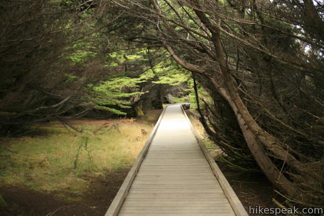
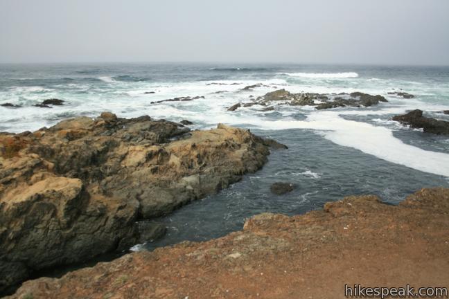
Located three miles north of Fort Bragg in Mendocino County, MacKerricher State Park is an excellent place to step out and enjoy the North Coast of California. At the center of the park is Lake Cleone, a small freshwater lake within crawling distance of the Pacific. In addition to the 1.3-mile trail around that lake, a short enjoyable boardwalk goes to Laguna Point Seal Watching Station. This easy hike is 0.6-miles round trip with less than 25 feet of elevation change and plenty of ocean views.

A loop is built into the boardwalk, but all of the attractions are found along the ocean-side of the walk, so feel free to convert the loop into an out and back, favoring ocean views over less dramatic grasslands. En route to the Seal Watching Station, where a panoramic viewing platform has been built, you will pass two more informative overlooks, and a tide pool area, where steps allow access to the gravelly coast.
The first overlook provides northward views and is accompanied by panels explaining how earthquakes, wind, and waves carved the area’s coast. You will also receive a short history lesson on Laguna Point’s past as a port for lumber schooners transporting material to San Francisco. Posts from the railway used to convey lumber from a nearby mill to Laguna Point are still visible on the beach to the north.
More informative panels are at the Laguna Point Seal Watching Station. These describe the birds and aquatic mammals visible from this location. After finishing your reading, linger with an eye on the water and sky. If you time your visit during the spring or fall, you may witness gray and humpback whales making their great migration past Laguna Point.

Dogs are allowed on leash for this short easy hike with less than 25 feet of elevation gain. On your way in or out of the park, be sure to take a look at the whale skeletons next to the entrance station. MacKerricher State Park has an $8 day use fee, but no permit is required to hike the Laguna Point Boardwalk.
To get to the trailhead: From Hoghway One, three miles north of Fort Bragg and 40 miles south of Legett at the junction with the 101, turn west at the MacKerricher State Park entrance sign on to MacKerricher State Park Road. Pass the entrance station and turn left, taking Mill Creek Road a short distance to the trailhead at road’s end.
Trailhead address: MacKerricher State Park Road, MacKerricher State Park, Fort Bragg, CA 95437
Trailhead coordinates: 39.48909, -123.799623 (39° 29′ 20.72″N 123° 47′ 58.64″W)
View MacKerricher State Park in a larger map
Or view a regional map of surrounding Northen California trails and campgrounds.
 | Salt Point Trail This out and back hike explores the jagged coast at the heart of Salt Point State Park. |
 | Durphy Creek Trail - Tan Oak Springs Trail - Lookout Point Loop This 3.75-mile loop climbs 1,000 feet to a forest ridge before descending to Lookout Point, where you can enjoy an unimpressive view to the south. |
 | Woodland Trail This 1.25-mile loop explores patches of redwoods surrounded by a shaded oak forest in Richardson Grove Redwoods State Park. |
 | Gould Grove Trail This half mile loop explores an old growth redwood forest across from the visitor center in Humboldt Redwoods State Park. |
 | Founders Grove Nature Trail This 0.5 mile loop explores an ancient grove honoring the founders of the Save-the-Redwoods League in Humboldt Redwoods State Park. |
 | Fern Canyon Trail This one-mile hike explores an incredibly ferny canyon in Prairie Creek Redwoods State Park. |
 | Stout Memorial Grove This 0.55-mile hike explores an old growth grove of coastal redwoods in Jedediah Smith Redwoods State Park. |
 | More hikes in Northern California Explore other trails in Northern California, including hikes around Mount Shasta. |


Go the extra miles...
Submit a rating of this hike to go with your comment. Contribute to the average trail rating.